In the MOANO project we aim to create an end-user modelling environment to design and generate multimodal mobile Geographic Information Systems (GIS) capable of evolving over time. Here we discuss different challenges and suggestions to address them using a Model-Driven Engineering (MDE) approach.
The use of mobile devices is very widespread. Mobile devices are communication tools that give users access to different computing services and are generally equipped with various sensors. Many applications take advantage of these attributes and consequently some new uses have emerged. The portability and precise positional information offered by modern mobile GIS means that they are far more user-friendly than traditional devices. However, there is still much scope for the development of ‘good practices’ in the use of mobile GIS, for example the best fit of needs or more natural interactions still requires much work.
In order to accelerate the development of these ‘good practices’, we propose through the MOANO project (Modèles et Outils pour Applications NOmades de découverte de territoire - 'Models and Tools for Pervasive Applications focusing on Territory Discovery') to allow end-users to build their own mobile GIS and evolve them over time using a dedicated modelling environment. Botany was chosen as our investigated field since botanists need mobile GIS in their daily tasks to access their noted observations and botanical information (Figure 1). The project also addresses multimodal interactions to overcome the limitations of mobile devices and to fully exploit their sensors. Multimodal interactions are user interactions through different modalities such as gesture and voice and the capability to use them simultaneously or alternately.
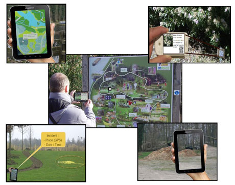
Figure 1: Using the augmented reality in the botanical garden
'Good practices' will be developed with the help of input from the botanists involved. First they will create their multimodal mobile GIS according to their initial needs. Then they will identify the different use constraints and evolve their systems according to the identified new needs. Thus, the 'good practices' of multimodal mobile GIS shall be defined and used over time by users themselves with less computer engineer involvement.
We use a MDE-based approach for this project since it utilizes models in the first stage of development. The main benefit of models is their use of visual representations which are a good communication tool (to be more relevant, modelling should be performed by different users). In addition, they are not technology-dependent (for languages or frameworks for instance), thus botanists can create their own business process models at a high abstraction level.
In order to create our desired MDE-based modelling environment we explored the following challenges:
- Multimodal interaction modelling
Multimodal interaction design and development have always been considered to be difficult tasks. This is due to the need to support various interaction modes, the different input and output devices and the required set of recognition technologies. In addition, the combination of modalities introduces other challenges related to time and event management. We propose the use of a multimodal modelling language to tackle these challenges. Current languages are generally limited to one direction (input or output) whereas we consider both directions in our project. In addition, we need a user appropriate modelling language targeting botanists. Thus a new end-user modelling language is required to design the multimodal interaction. - The domain modelling
We also need to define a language for botanists to express the software solution that they intend to use. This language must offer enough concepts to cover their needs, offer sufficient benefits to be worth using and be accessible for end-users. - Concept presentation
The visual concept notation must be chosen according to the botanist's profile (for instance gardener or manager). Its cognitive efficiency can be evaluated using many endpoints such as semiotic clarity, ie using one symbol to represent a given concept (vocal modality must be represented by two icons since it is used in input and output). But how can we evaluate the clarity? Indeed, the quantitative evaluation of the model's quality is currently a problem by itself. - Interpretation and evolution of the model
The modelling environment should provide the correct interpretation of the botanist's models and allow their evolution. The major evolving challenge for the model is to maintain traceability links between model elements and to ensure consistency with user's specified evolutions. In addition, another challenge is related to the model's interpretation using multiple visual notations since they change according to the users profile.
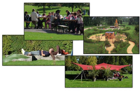
Figure 2: The MOSAIC Park
We started our project by collaborating with botanists through our partner in MOSAIC Park (Figure 2). Currently, we are addressing the challenges outlined here by offering the botanists a modelling tool based on the Wizard of Oz experiment.
Link:
http://moano.liuppa.univ-pau.fr/
Please contact:
José Rouillard
Laboratoire d'Informatique Fondamentale de Lille (LIFL)
University of Lille, France
Tel: +33 3 20 33 59 37
E-mail:

