by Claudio Lucchese, Raffaele Perego, Salvatore Trani, Makis Atzemoglou, Benoit Baurens and Dimitris Kotzinos
InGeoCloudS is a project funded by the European Commission under the CIP-Pilot actions program. The goal of InGeoCloudS is to design and build a cost-effective platform for data publication and services, able to promote collaboration and innovative development in the European environmental and geological/geophysical science domain.
The Inspired Geodata Cloud Services (InGeoCloudS) project, coordinated by AKKA Informatique et Systèmes (France) was launched in February 2012 with the aim of establishing the feasibility of using a Cloud-based approach for the publication and use of geodata across Europe. The initiative seeks to leverage the economies of scale achievable for a multi-consumer consortium and its ubiquitous availability of access for the geographically distributed end-users of the European institutions in the environmental field. The purpose is to demonstrate that a Cloud infrastructure can be used by public organizations to provide more efficient, scalable and flexible services for creating, sharing and disseminating spatial environmental data. InGeoCloudS is exploiting this concept based on the work of eight partner institutions from five different countries (including ERCIM members CNR, Italy and FORTH, Greece); some partners are IT enterprises and some are public data providers, covering hydrogeology and natural hazards applications. The project roadmap entails two main steps: Pilot1, which is currently available to project partners, and Pilot2 that will open up the services to a broader audience in summer 2013. The whole set of services will be available for free for the duration of the project.
Environmental science, like other fields, both benefits and suffers from an avalanche of data. From an IT resource management perspective, hardware and network resources have become a critical bottleneck and major cost item. One of the main characteristics of the Cloud is that its resources are virtually unlimited in terms of storage and computing power – it scales transparently and in a semi-automated manner, while offering up-to-date underlying technology – and it offers a pay-as-you-go/pay-per-use delivery model with potential reduction of traditional IT infrastructure costs.
From a scientific point of view, rising data quantity and quality has not been accompanied by an equivalent increase in visibility, accessibility and sharing. The 2007 Infrastructure for Spatial Information in the EC (INSPIRE) Directive established rules for geographic and environmental data to ensure that the geodata are consistently available, interpretable and usable across European regional and state boundaries. The Directive requires the use of established standards and online availability of geodata. InGeoCloudS services intend to support and respect all obligations stemming from the INSPIRE Directive and to facilitate data providers in fulfilling their obligations.
The InGeoCloudS platform is structured in three main software layers. The most basic one provides applications with transparent access to an elastic distributed file system, a GIS-enabled database server, and to some compute facilities for managing on-demand jobs and elastic services. The second layer provides higher-level services including elastic pool of map servers, database synchronization mechanisms, and also an advanced data publication service which allows data providers to publish OGC services and their corresponding datasets by simply uploading their data in some standard format and exploiting the geo-publication services of the InGeoCloudS infrastructure. The last layer includes the Web portal and an elastic web servers pool hosting the front-end of geo-applications.
One of the most innovative InGeoCloudS services is the Linked Open Data based data and metadata management service. The InGeoCloudS consortium designed an interoperable Geo-Scientific Observation Model (GSOM) that allows the mapping of different data sources into a harmonized data/metadata representation space. Thus the potential users of the platform would have the ability to publish their data as Linked (Open) Data and link them to existing data either inside or outside of the platform. By exploiting this model and RDF-based technologies, InGeoClouds opens the doors to cross-country queries as well as cross-discipline analysis, e.g. facilitating correlation of data between various scientific domains.
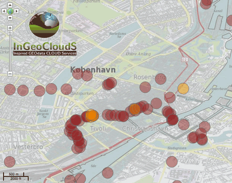
Three main use cases are currently hosted by the platform: (i) Geohazard management in Slovenia, which provides an early landslide warning system on the basis of past landslides, rainfall forecasts and geology for 14 Slovenian municipalities. (ii) Measurement of earthquake post-effects in Greece, with automated notification services for interested parties implemented by the Earthquake Planning and Protection Organization (EPPO). (iii) Integration of generalized services for groundwater management, showing areas where high concentrations of pesticides can be met or displaying samples chemical analysis. These use cases are owned by geological institutes in Denmark, France and Greece (GEuS, BRGM and EKBAA/IGME) and illustrate how pan-European exploitation of data can be achieved.
We hope to make InGeoCloudS a sustainable platform capable of attracting data providers from diverse horizons. Every owner of geoscientific data (not just geologists) is expected to find the platform and its services attractive, facilitating the publishing of data to larger and broader audiences and developing new services economically. Consortium members – and possibly other partners – will offer both scientific and necessary IT skills in this endeavour, far beyond the project’s timespan.
Link: http://www.ingeoclouds.eu/
Please contact:
Claudio Lucchese
ISTI–CNR, Italy
Tel: +39 050 3152468
E-mail:

